Drone des Champs
  • About us
  • Services
    • Agriculture
    • Environment
    • Building and Civil Engineering
    • AI
  • Contact Us
  • Français
Select Page
Onions density maps – NDVI / NDRE – Multispectral imagery

Onions density maps – NDVI / NDRE – Multispectral imagery

by Gil | Mar 17, 2021 | Uncategorized

Learn how drones helped this farm to build a density map of their onion yield and improve the profit by actively monitoring the quality of their field
Sod Turf – Stress Area Analysis  – Multispectral imagery

Sod Turf – Stress Area Analysis – Multispectral imagery

by Gil | Mar 5, 2021 | Réalisations, Réalisations, Réalisations, Réalisations

Carrots – Stress Area analysis – RGB

Carrots – Stress Area analysis – RGB

by Gil | Mar 5, 2021 | Uncategorized

Weed detection on leeks production – RGB

Weed detection on leeks production – RGB

by Gil | Mar 5, 2021 | Réalisations

Onions density maps – NDVI / NDRE – Multispectral imagery

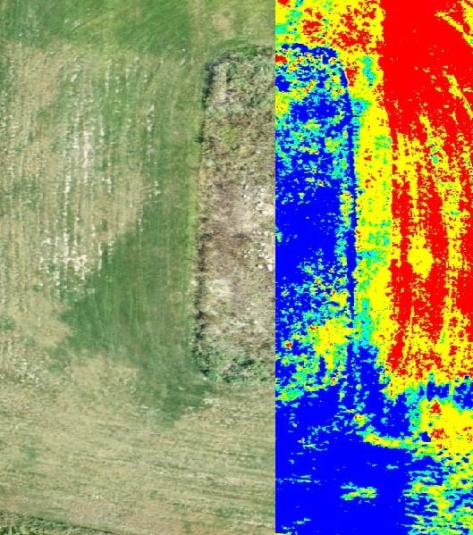
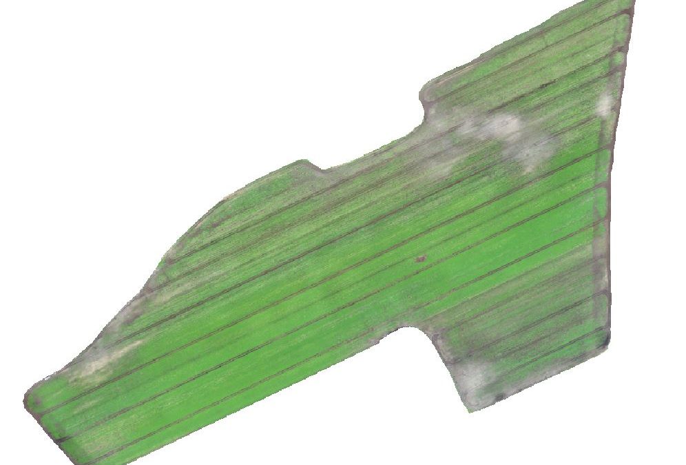
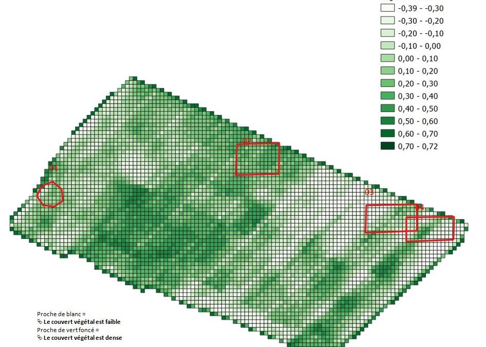
Onions density maps – NDVI / NDRE – Multispectral imagery

by Gil | Mar 5, 2021 | Agriculture, Agriculture, Agriculture, Agriculture, Agriculture

TEST FR

Search

Recent Posts

  • Onions density maps – NDVI / NDRE – Multispectral imagery
  • Sod Turf – Stress Area Analysis – Multispectral imagery
  • Carrots – Stress Area analysis – RGB
  • Weed detection on leeks production – RGB
  • Onions density maps – NDVI / NDRE – Multispectral imagery

Recent Comments

    • Facebook
    • Instagram
    © 2024 – All right reserved | Drone des champs